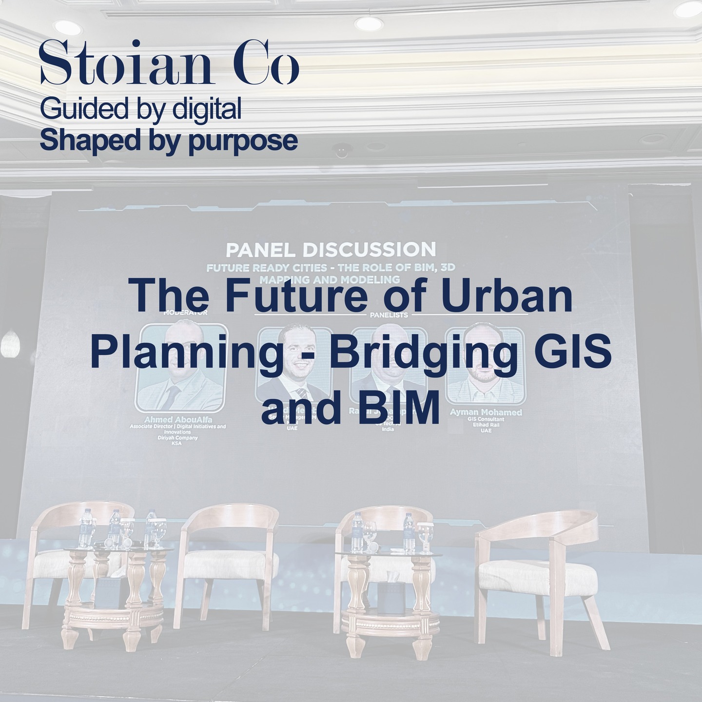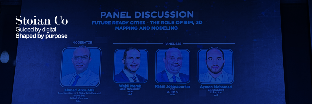
On February 24, I attended a thought-provoking panel discussion on the Integration of GIS and BIM in Urban Planning. Speakers from across the industry underscored a game-changing reality: merging geospatial data with Building Information Modeling (BIM) is revolutionizing how we design, construct, and manage our urban environments.
Why This Integration Matters
- Holistic View: GIS adds the “where” factor to BIM’s “what and how.” By layering spatial insights on top of 3D building models, urban planners gain a multi-dimensional perspective, empowering them to pinpoint where resources are needed most.
- Real-Time Updates: With digital twins and real-time data feeds, planners and stakeholders can react swiftly to on-site changes, streamlining everything from material logistics to scheduling.
- Sustainability & Efficiency: By incorporating environmental data into BIM models, teams can spot new opportunities for green building designs, energy savings, and more sustainable infrastructure.
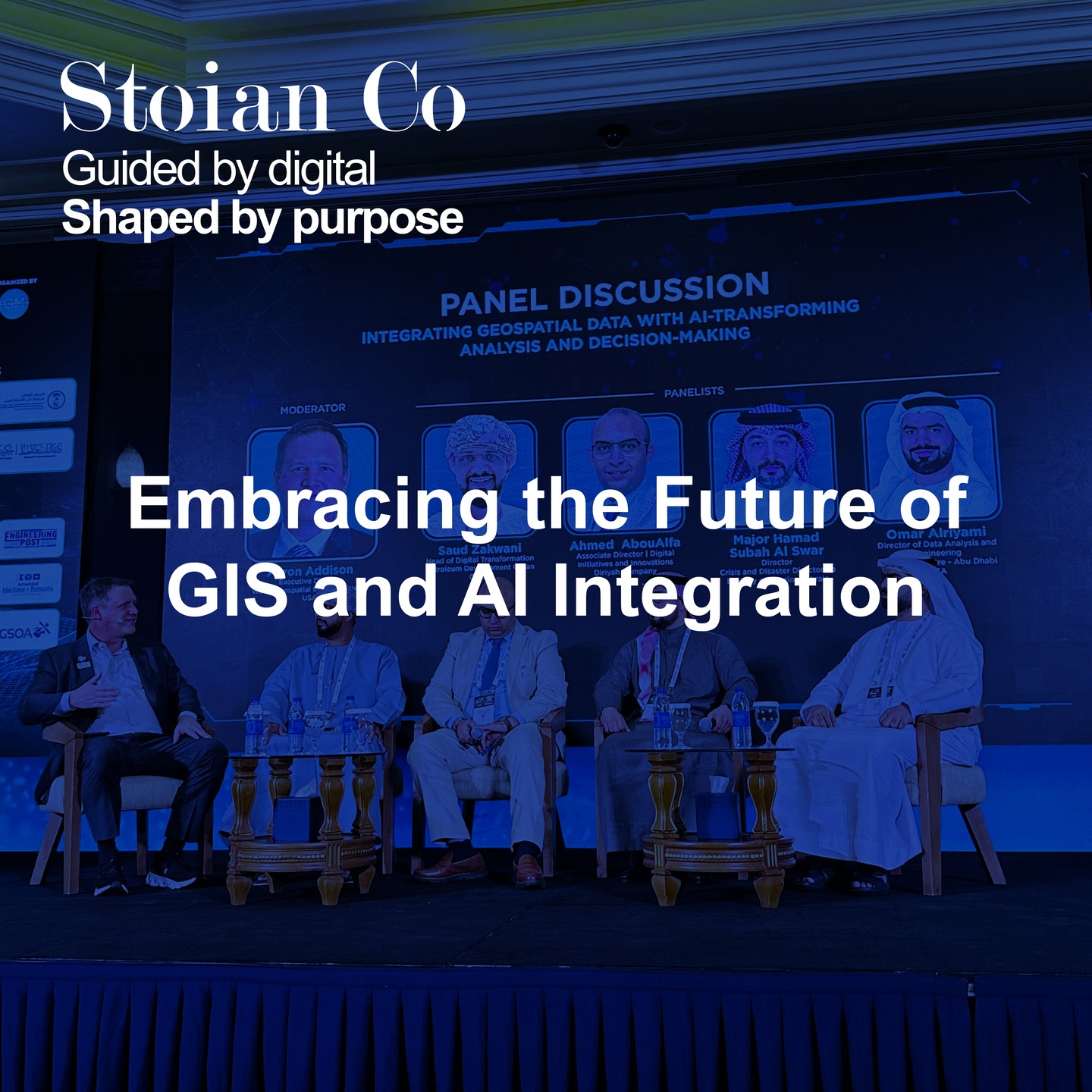
Key Industry Trends
- Digital Twins
Building on both BIM and GIS, digital twins simulate real-world conditions—allowing for scenario testing to improve design, reduce cost, and plan for the unexpected. - Stakeholder Engagement
Successful digital transformation hinges on change management. Educating and involving project owners, local authorities, and community groups ensures everyone maximizes the potential of GIS-BIM solutions. - Data-Driven Decision-Making
As more sensors and reality capture technologies (like drones and laser scanners) feed into these models, data becomes the single source of truth for project decisions—from concept to operation.
Being Part of the Change
Urban planning and construction are evolving rapidly. Staying agile and informed is crucial for any organization operating in this space, whether you’re dealing with building designs, infrastructure proposals, or regional development plans. By adopting GIS-BIM integration early, your team can make well-informed decisions and keep pace with global sustainability mandates.
How I Can Assist
At Stoian Co, our mission is to bridge the gap between innovative tech and real-world implementation:
- Technical Consultation: We’ll help you assess your current workflows and pinpoint where GIS-BIM integration can make the biggest impact.
- End-to-End Project Support: From establishing digital twins to training teams on new software, we’ll guide you through each phase.
- Tailored Solutions: Every project has unique needs. We customize solutions—like real-time data visualization or sustainability audits—ensuring optimal results for your urban planning endeavors.
If you’re looking to future-proof your operations and lead the industry, let’s connect. Together, we can push the boundaries of what’s possible in modern city development.